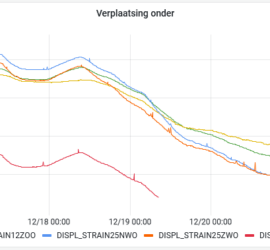
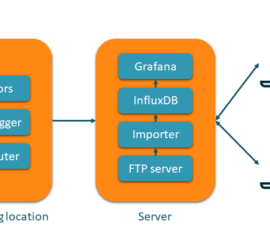
HaiPerMon is een applicatie voor geodetische en geotechnische monitoring. De kern wordt gevormd door InfluxDB, een moderne database voor tijdreeksdata. Deze wordt gevuld met de metingen van de sensoren op de monitoringlocatie. In de meeste gevallen […]
Web
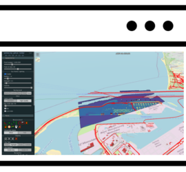
Geografische informatie vereist vaak specialistische software voor het bekijken en analyseren hiervan. Daarbij komen de enorme hoeveelheden data die in het bijzonder in het geval van puntenwolken uitgewisseld moeten worden. Dit maakt het voor eindgebruikers moeilijk […]
Geodetic and geotechnical monitoring is an important task within the field of surveying. It is often employed to monitor critical buildings and infrastructure during construction works. One of the highlights of my geodetic career was the […]
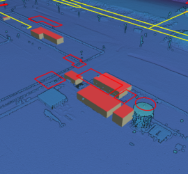
In my previous post I showed how to use Potree to create a web viewer for point clouds. But it doesn’t stop there, as Potree is also capable of displaying other geographic data. The Shapefiles example […]
Potree is the de-facto standard web viewer for point clouds. It can display huge point clouds by showing only the relevant parts of the cloud. It can display using all attributes of a LAS/LAZ file and […]
A colleague asked my whether it would be possible to view the current location of a user in a Leaflet-based GIS viewer. Luckily, this is very easy to do, as explained in this tutorial. All you […]
When I was looking for a simple way to publish GIS data on the web, a colleague suggested Leaflet. This is an easy to use Javascript library that is ideal for publishing e.g. the content of […]


