When I saw the announcement for this book on the O’Reilly website, I knew immediately that I had to get it. My programming background is in C/C++/C# and I’ve only been using Python for a year […]
QGIS
16 berichten
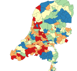
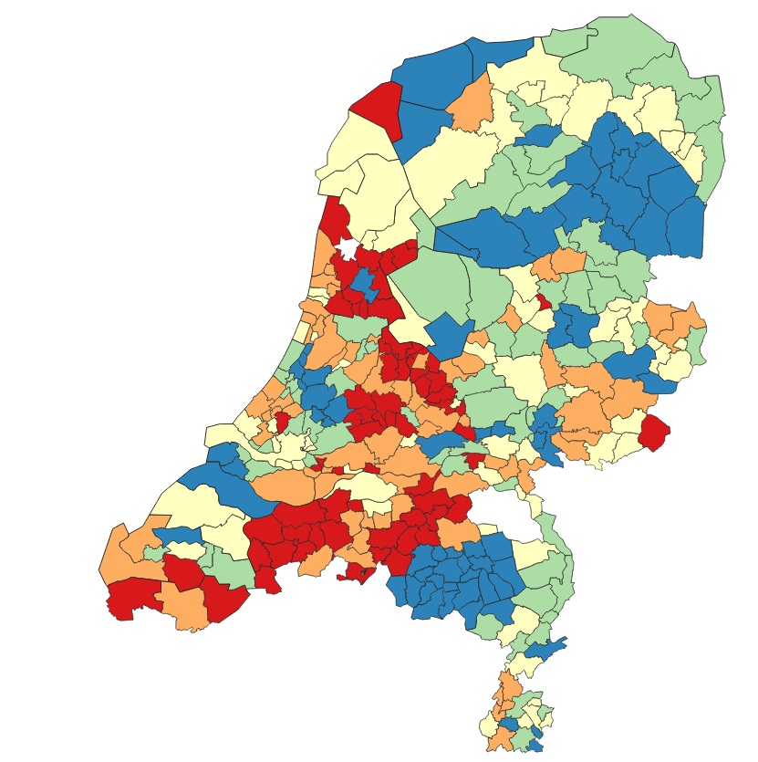
Since the beginning of Covid-19, I’ve from time to time downloaded the official Dutch Covid-19 statistics (available here) and created my own plots, using a Jupyter Python notebook that you can find over on Github. But […]

When I was looking for a simple way to publish GIS data on the web, a colleague suggested Leaflet. This is an easy to use Javascript library that is ideal for publishing e.g. the content of […]
One of the data types supported by QGIS are XYZ tiles, i.e. tiled image data in a Pseudo-Mercator projection. By default, QGIS only has OpenStreetMap as tile provider. To do so, you right click on XYZ […]
By default, QGIS asks you which coordinate system to use when a layer that you add does not have a coordinate system mentioned in its metadata. Unfortunately, this is quite often the case, and can become […]
By default, QGIS uses your Windows language as language for the user interface. While this might be desirable to some users, this may also cause two issues: Sometimes, the localization isn’t of the best quality, making […]