The Cloud-Optimized Point Cloud (COPC) format is an extension to the popular LAZ file format for point clouds. It adds spatial subdivision and an index to the end of a LAZ file that makes it possible […]
Portfolio
7 posts
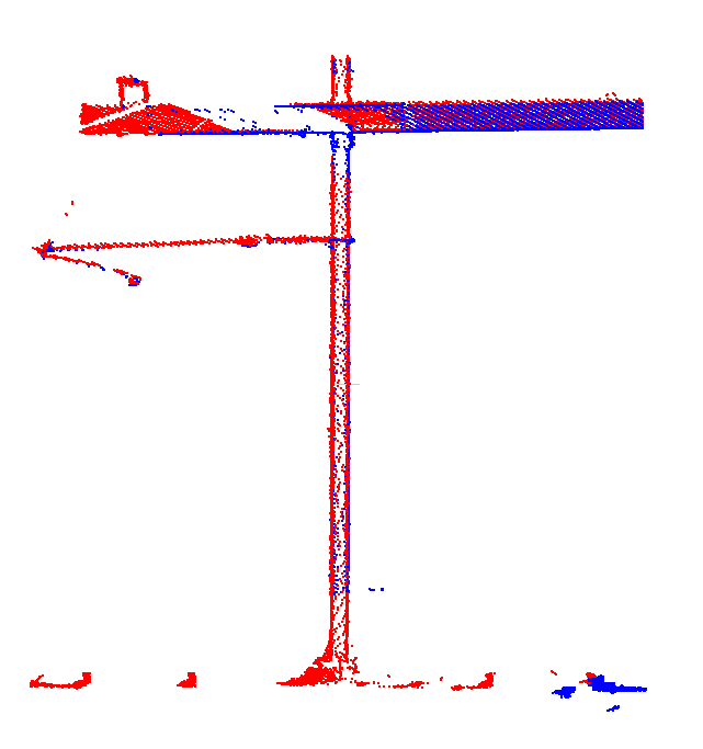
I’ve previously written about the challenges of adjusting Mobile Mapping data, such as finding suitable geometry and proper weighting of overlapping drivelines. Another issue arises where drivelines branch and rejoin. Below drawing shows the top view […]
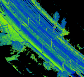
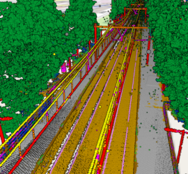
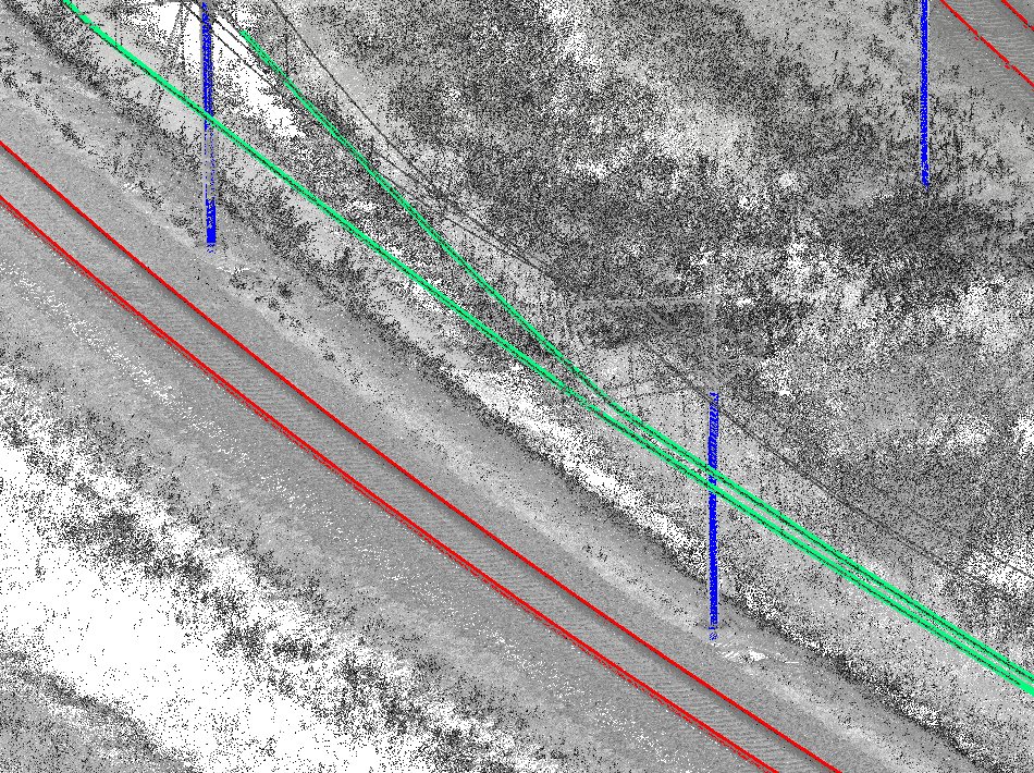
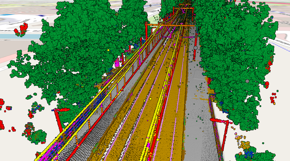
Point clouds acquired through laser scanning with mobile mapping systems mounted on rail vehicles have become the de-facto standard for efficient large-scale mapping of rail infrastructure. Unfortunately, point clouds are large and unstructured heaps of data […]
I have many years of experience with Mobile Mapping and created various related software packages. Trajectory analysis Processing Mobile Mapping data starts with computing a good trajectory. I’ve written TTools to analyse trajectories in Inertial Explorer […]
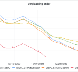
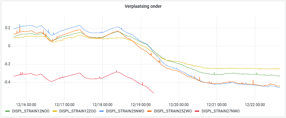
HaiPerMon is an application for geodetic and geotechnical monitoring. At its core sits InfluxDB, a modern database for time series data. This is filled with the measurements from the sensors at the monitoring location. In most […]
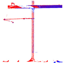
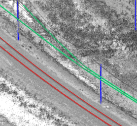
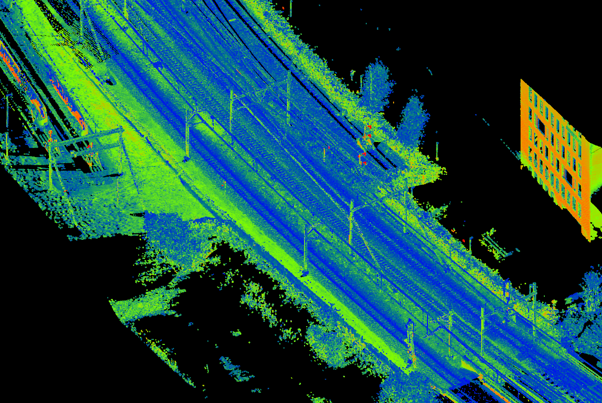
Laser scanning produces huge amounts of data. The challenge is to extract meaningful information from these point clouds in an efficient manner. The first step is classifying the point clouds. There are different approaches to automatic […]
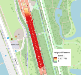
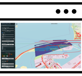
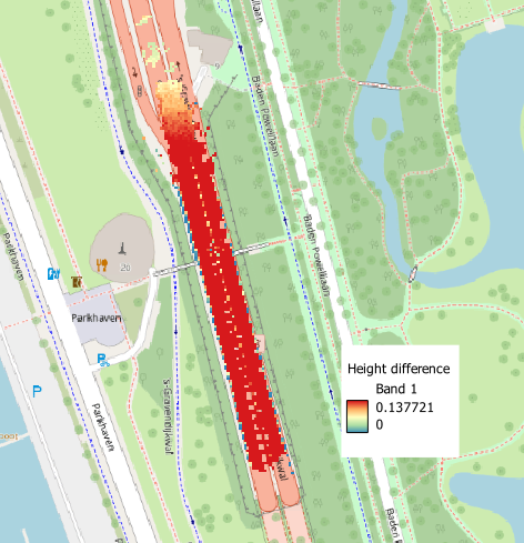
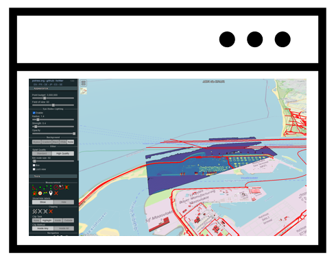
Geographic information often requires specialist software for viewing and analysis. An additional challenge is the large data volume, especially in the case of point clouds. This poses a challenge for easy viewing and querying of this […]