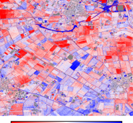
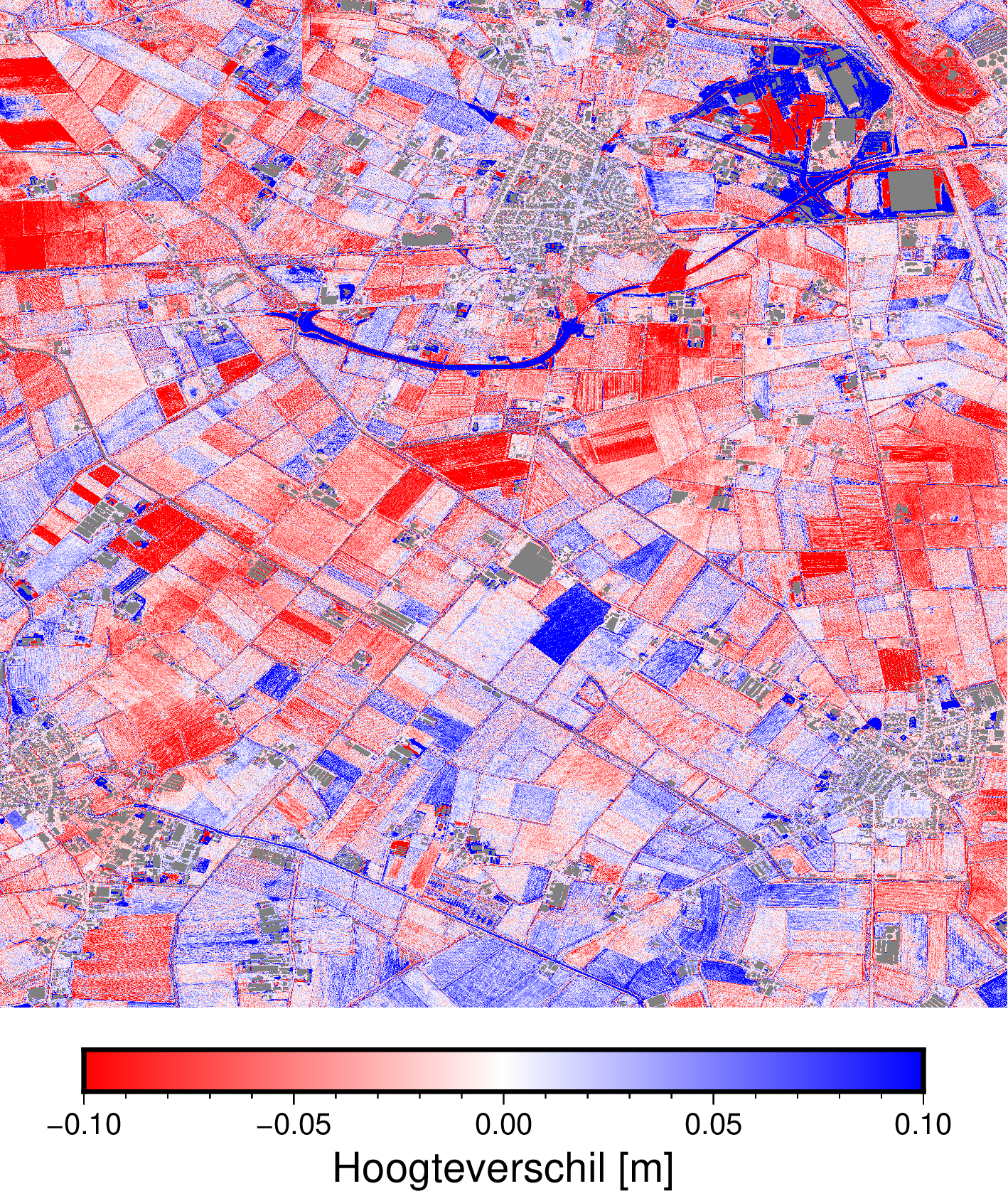
In Nederland hebben we met het Actueel Hoogtebestand Nederland een schitterend landelijk hoogtebestand. Schitterend omdat het open data is, van goede kwaliteit (5cm stochastisch + 5cm systematisch), hoge resolutie voor een airborne LiDAR bestand, geclassificeerd en […]
Blog
89 berichten
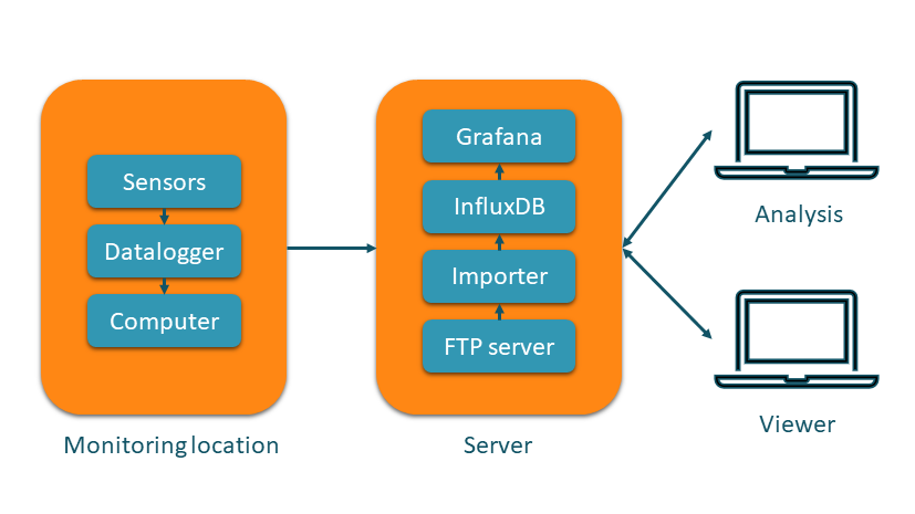
Geodetic and geotechnical monitoring is an important task within the field of surveying. It is often employed to monitor critical buildings and infrastructure during construction works. One of the highlights of my geodetic career was the […]
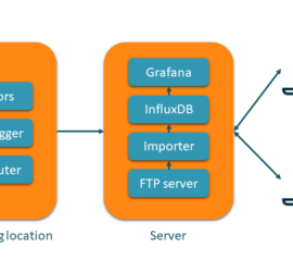
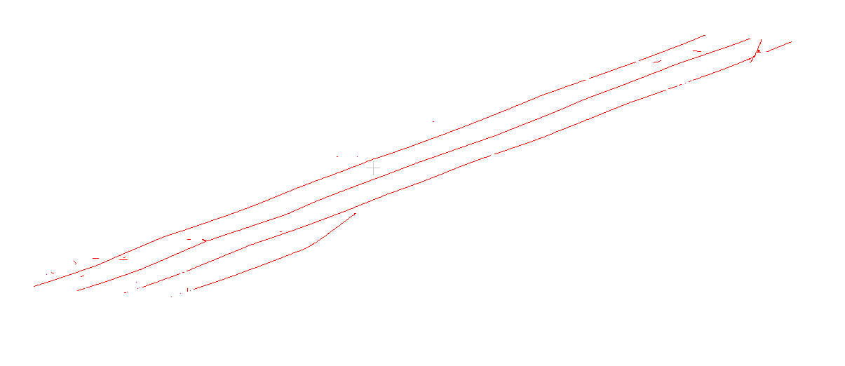
ProRail gebruikt een tekstformaat genaamd KRDZ (wat volgens mij staat voor koördinatenbestand met Z) voor het uitwisselen van meetgegevens van het spoor. Meetbedrijven leveren metingen als KRDZ aan ProRail, en uit de ProRail applicatie Sigma kun […]
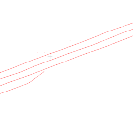
So you’ve digitized lines in QGIS into a shapefile, but want to save the vertices as ASCII file to do other stuff with them? This is not as straightforward as it might seem at first. The […]
I usually use CloudCompare as viewer for point clouds, as it is really easy to visualize different point attributes. But when vectorizing features from point clouds, I want to display them as linestrings, not individual vertices. […]

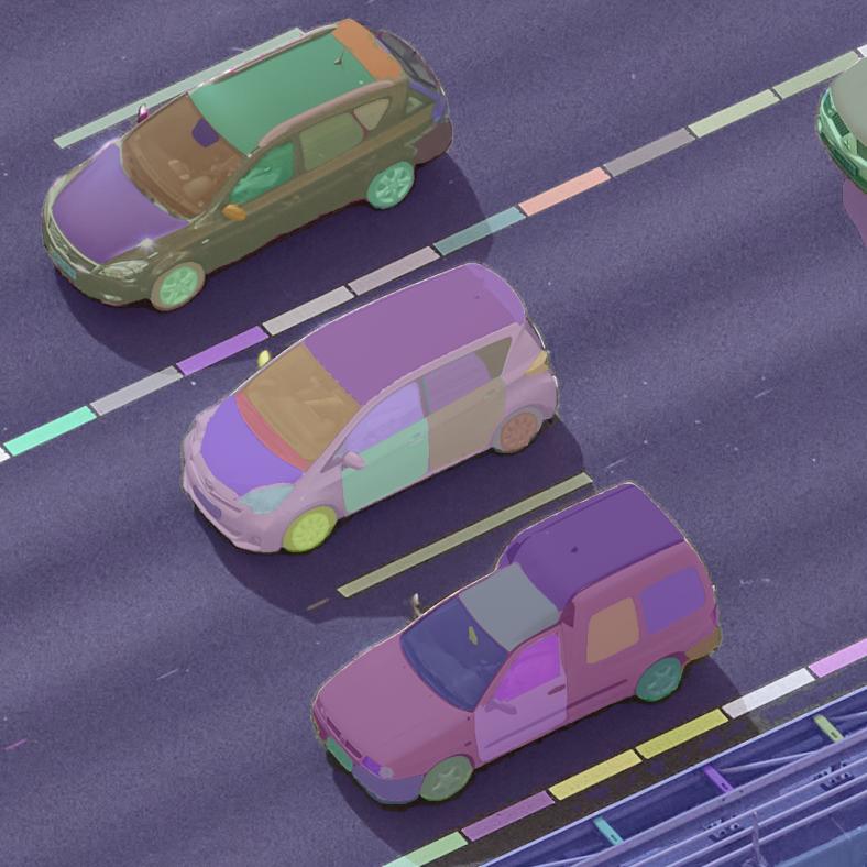
Meta AI Research has released Segment Anything, a model that can do automatic semantic segmentation of images without prior training for a specific application. The code, pre-trained models, and the training dataset are publicly available. After […]

The latest edition of German computer magazine C’t has a feature on Stable Diffusion and deploying it on your own hardware, which triggered me to install it on my desktop PC. While AMD graphics cards are […]
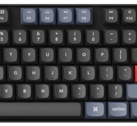
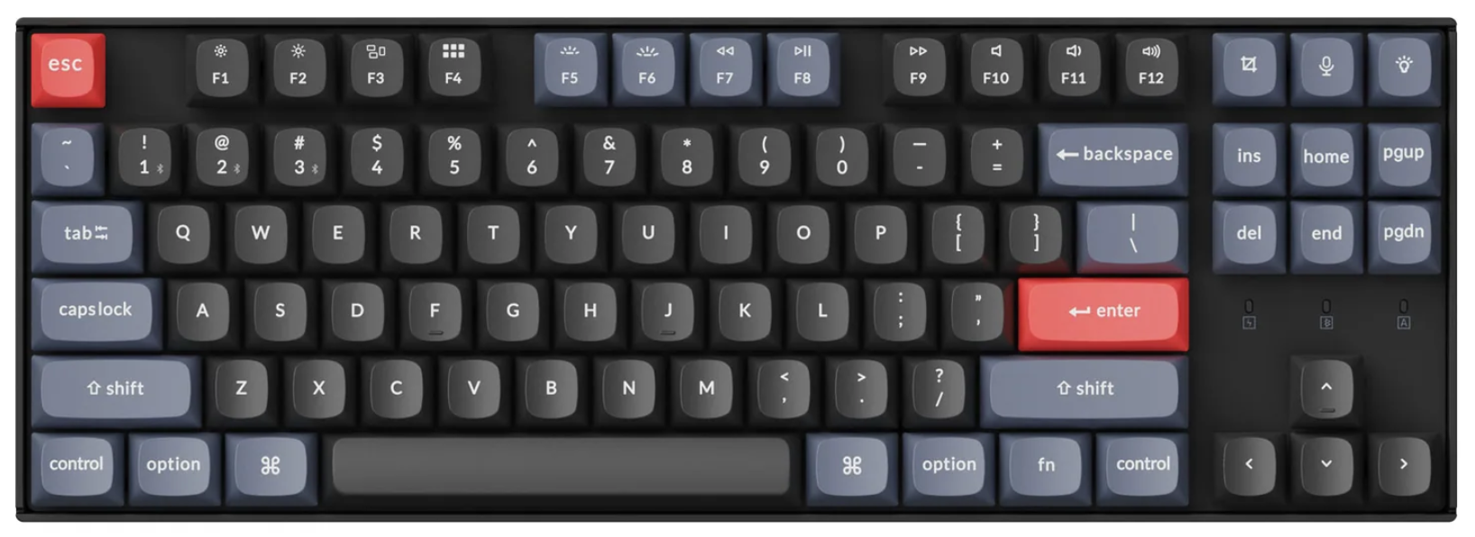
As I’ve written in my review of my HP ZBook Power G9, I wasn’t entirely happy with the keyboard layout. The half-height cursor and top-row buttons are annoying. I tried to deal with it by using […]

A customer of mine processes data in tiles of 50x50m size, then merges them into larger tiles of 1x1km size. I wrote a QGIS plugin to take care of all necessary steps, but there are cases […]